

A 50 percent chance of above-average rainfall has been forecast for much of Australia from now until the end of January.
 |
|
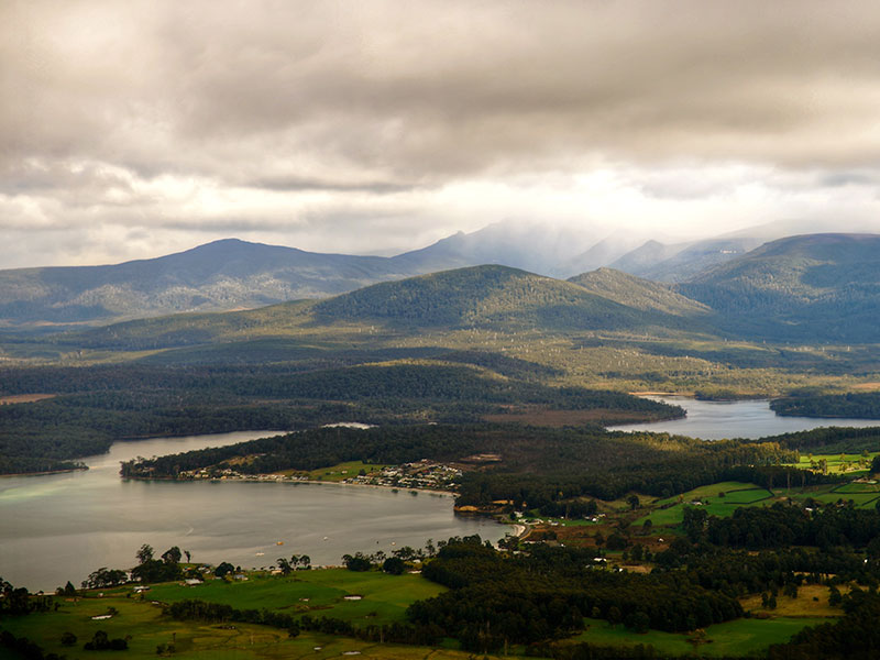
Photo: Mariusz Kluzniak/Moment/Getty Images
|
However, the Bureau of Meteorology’s latest rainfall outlook shows that November is likely to be drier than usual for most of Western Australia, South Australia and Victoria. The chance of getting above-normal rainfall is below 30 percent in the southern half of WA.
November to January daytime and overnight temperatures are likely to be warmer than average for most of the country, with the highest chances over Tasmania, Victoria and northern Australia. Elsewhere, the chance of a warmer three months is close to 50 percent.
Ocean temperatures have been cooling rapidly in the Pacific Ocean, and this is likely to continue towards La Niña levels over the coming months.
However, given the competing influence of other climate drivers (weakly warm waters to the north of Australia, and cooler waters in the Indian Ocean), current outlooks do not favour widespread rainfall across Australia that is typical of most (two thirds) of past La Niña events.
Ocean temperatures around Australia are forecast to be near average during the November to January period, which is also providing little push towards wetter or drier conditions.
In addition to the natural drivers such as the El Niño-Southern Oscillation and the IOD, Australian climate patterns are being influenced by the long-term increasing trend in global air and ocean temperatures.
“Most models now suggest that La Niña might form by late 2017, so our ENSO Outlook has moved to La Niña Watch,” BOM senior climatologist Dr Andrew Watkins says.
“If La Niña does develop it’s likely to be short-lived and much weaker than the last event in 2010 to 2012, when Australia experienced its wettest two years on record.
 |
|
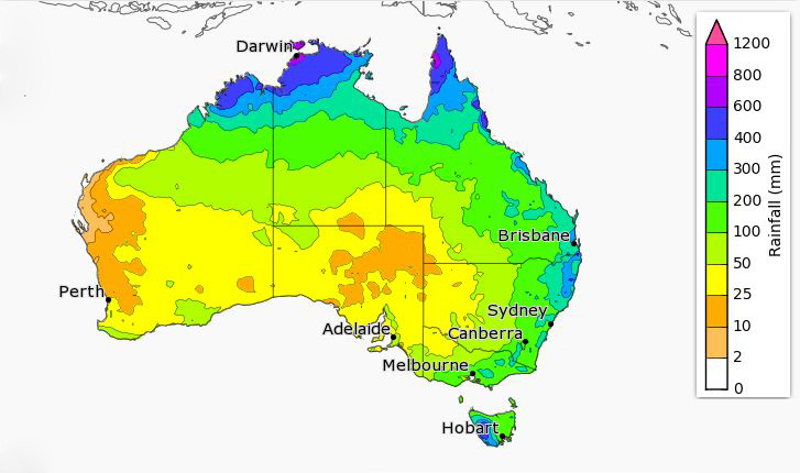
Rainfall totals that have a 75 percent chance of occurring for November to January. Source: BOM
|
“The rainfall outlook for November to January is mostly neutral,” Watkins adds. “That means climate drivers are not pushing us towards a particularly wetter or dryer season than usual.
“When this is the case, rainfall can still range from average to substantially above or below average – but it’s less likely to be at the extreme ends of the scale.”
Looking back to October, Watkins says that, following a very dry winter in many parts of the country, October rainfall was above average in Queensland and northern New South Wales.
“In some areas this produced flooding,” he says. “Bundaberg received its October average rainfall in one day … not just once but three times in the month!
“However, the heavy rains failed to reach some southern areas. Serious rainfall deficiencies remain in parts of NSW and South Australia.
“The extra cloud cover over parts of Queensland meant warmer nights than usual in October, but cooler days. On the other hand, much of southern Australia had warmer than average days.”
Soils remain dyer than average for time of year across NSW, eastern Victoria and the eastern agricultural regions of South Australia. Further north, where the most rain fell, soil moisture levels have improved significantly.
Watkins says southern water shortages are nearing the end of their traditional winter filling season, In Tasmania and the South-West Coast levels are higher than at this time last year (62 percent vs 56 percent, and 50 percent vs 41 percent, respectively).
However, storages are lower in the Murray-Darling Basin and southern Victoria (73 percent vs 81 percent and 51 percent vs 60 percent, respectively).
Turning to streamflows, Watkins says that, after a mostly dry winter, “rains in October soaked into dry soils at first so the streamflow outlook for October to December is for mostly near-median or low streamflows – particularly in the east where soils are driest”.
 |
|
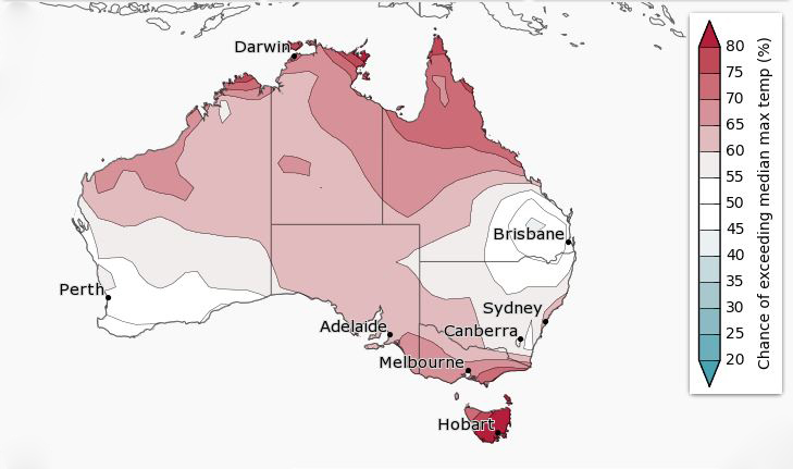
The chance of above-median maximum temperatures for November to January. Source: BOM
|
In terms of temperatures, days and nights are likely to remain warmer than average in large parts of northern Australia as well as in parts of the south-east.
A shift towards a weak La Niña can increase the chance of heatwaves for south-eastern Australia.
“Tropical cyclone season also begins in November, so the time to prepare is now,” Watkins says. “On average 10 to 13 tropical cyclones develop in our region each year, and about four cross our coast.
“This year’s outlook suggests a typical season is likely.”